Ramps and pathways
Crews carefully laid out a networks of paths and ramps to serve the work areas of each fishing room. Paths took advantage of local topography and often developed simply through habitual movement around the fishing room. But fishing crews often reinforced walkways and ramps with carefully-laid dry masonry and sometimes laid out rock curbs to define the edges of the constructed galets, used for drying fish. Ancient raised cobble beaches and steep escarpments, reflecting coastlines of 6000 to 8000 years ago are common topographical features on the Northern Peninsula, where the land is still rebounding from the last Ice Age. Fishing crews used these raised beaches to dry fish, so they constructed ramps to access them. The ramps often take advantage of natural breaks in the escarpment and are sometimes buttressed by rocky outcrops.
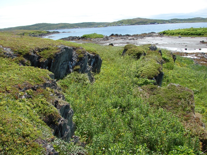
boundaries along a well-used walkway.
(EjAu-19).
Archaeology
Historic paths are often visible as vegetation shadows, where invasive plants act as indicators of human activity. Buttercup and wild parsnip are attracted to disturbed ground where differences in pH and soil density give them a competitive advantage over competing vegetation, so that they flag the routes once taken from one part of the fishing room to another. Flourishing growth is probably also encouraged by the high nitrogen content in fish, dissipated across these sites on the boots of fishermen, centuries ago. A good example of a constructed pathway survives at the French fishing room Ilot marchand, now Grandmother Island (EjAu-19), in Quirpon. There a walkway descends to a terrace, away from the main processing and drying areas. The pathway takes advantage of a natural cleft in the bedrock and has been artificially levelled along its length and ramped to make a more gentle incline.
With galets, the constructed ramps that connect work areas are often one of the most visible physical traces in the landscape of a fishing room.
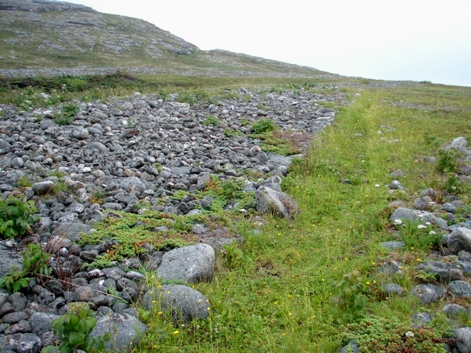
 The northern ramp, recognisable as the break in slope to the centre left of the image, at Champ Paya (EfAx-09, Feature 51) ascends from the stage area on the shoreline to the escarpment terrace above where drying galets are found.