An Archaeology of the Petit Nord
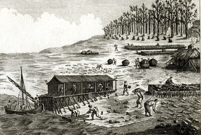
An archaeology of the Petit Nord: the maritime cultural landscape of the French, seasonal, shore-based, salt-cod fishery in northern Newfoundland, 1510-1904, is an on-going research project, funded by SSHRCC and directed by Peter Pope, a Professor of Archaeology at Memorial University of Newfoundland. For centuries, migratory fishing crews from Brittany and Normandy created seasonal shore stations on the Petit Nord, to salt and dry cod. This was how Europe first made commercial use of North America - so the fishing stations of this region form one of the oldest persistent European landscapes in Canada.
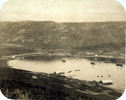
We are recording archaeological vestiges of these fishing stations and putting them into documentary, cartographic and photographic context. We can then consider how such places were selected and constructed for resource extraction; we can look at their relationships one with another; and we can hope to trace their evolution through time, to create a record of an important maritime cultural landscape.
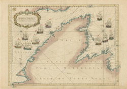
This is a multi-cultural history of interaction among Breton and Norman fishers; the people of the Mediterranean and Portugal where they delivered fish; the Beothuk, Innu and Inuit peoples they encountered in Newfoundland; European competitors from Britain and the Basque Country; and, finally, the English and Irish fisher-folk who eventually displaced them.
The early trans-atlantic fishery was dispersed among European ports and organized by custom, rather than being centrally directed. Fishing crews from particular regions returned again and again, in a seasonal rhythm, to particular coasts in the New World: the English to Newfoundland's Avalon Peninsula, the Bretons to the Petit Nord, the Basques to the Gulf of St Lawrence, and so on.
This raises several important questions:
- How was shore space distributed?
- Why did the known ethnic concentrations of fishers develop and evolve as they did?
- How were fishing stations selected?
- How were they laid out?
- How were they related one to another?
- How did they evolve over four centuries?
- How did European fishers shape the North American landscape?
This study involves identification, transcription, and interpretation of oral, documentary and cartographic resources, in addition to archaeological survey, excavation and interpretation. Our research strategy is to look at the Petit Nord at several different scales, ranging from the features making up a specific fishing establishment at Dos de Cheval, Crouse; to the array of fishing rooms around major harbours, like Crouse or Croque; to the choice of harbours by fishers along the whole coast of the Petit Nord.
At the narrowest scale, our research emphasizes archaeological investigation. Historic maps and fishing censuses, supplemented by focused excavation, play a greater role in interpretation of the distribution of crews around major harbours. The broad canvas of the whole Petit Nord is based, largely, on the documentary evidence, with field survey to capture a photographic landscape record. This website is a gallery of the photographic highlights of our research.